June 8, 2026
Bristol to Alicante: From Tidal Britain to Mediterranean Spain
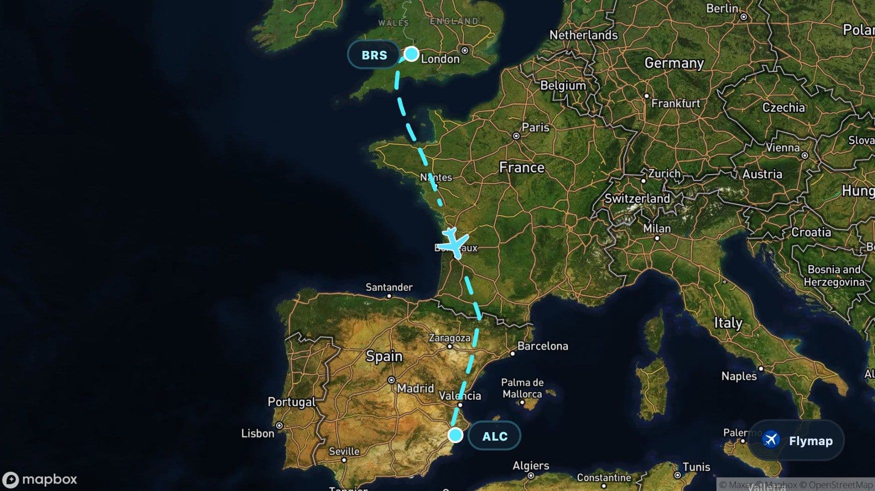
See what you may fly over from Bristol to Alicante-Elche Miguel Hernández, including United Kingdom, British Isles, Great Britain, Bristol Channel and English Channel.
Distance
1,572 km
Timing
2h 05m
Countries
3 countries
 Bristol
 United Kingdom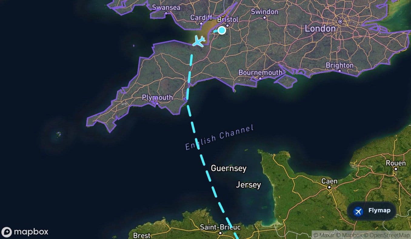
 British Isles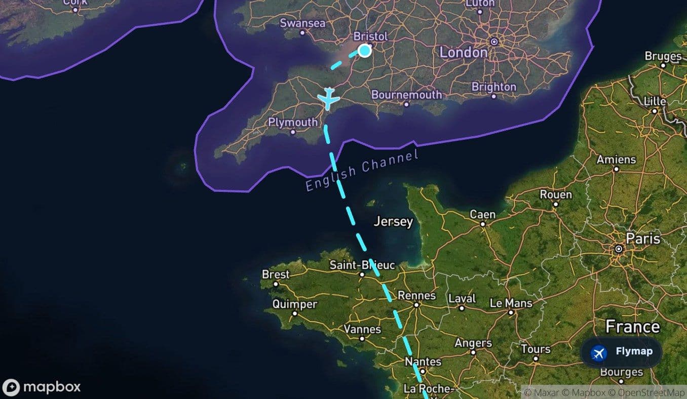
 Great Britain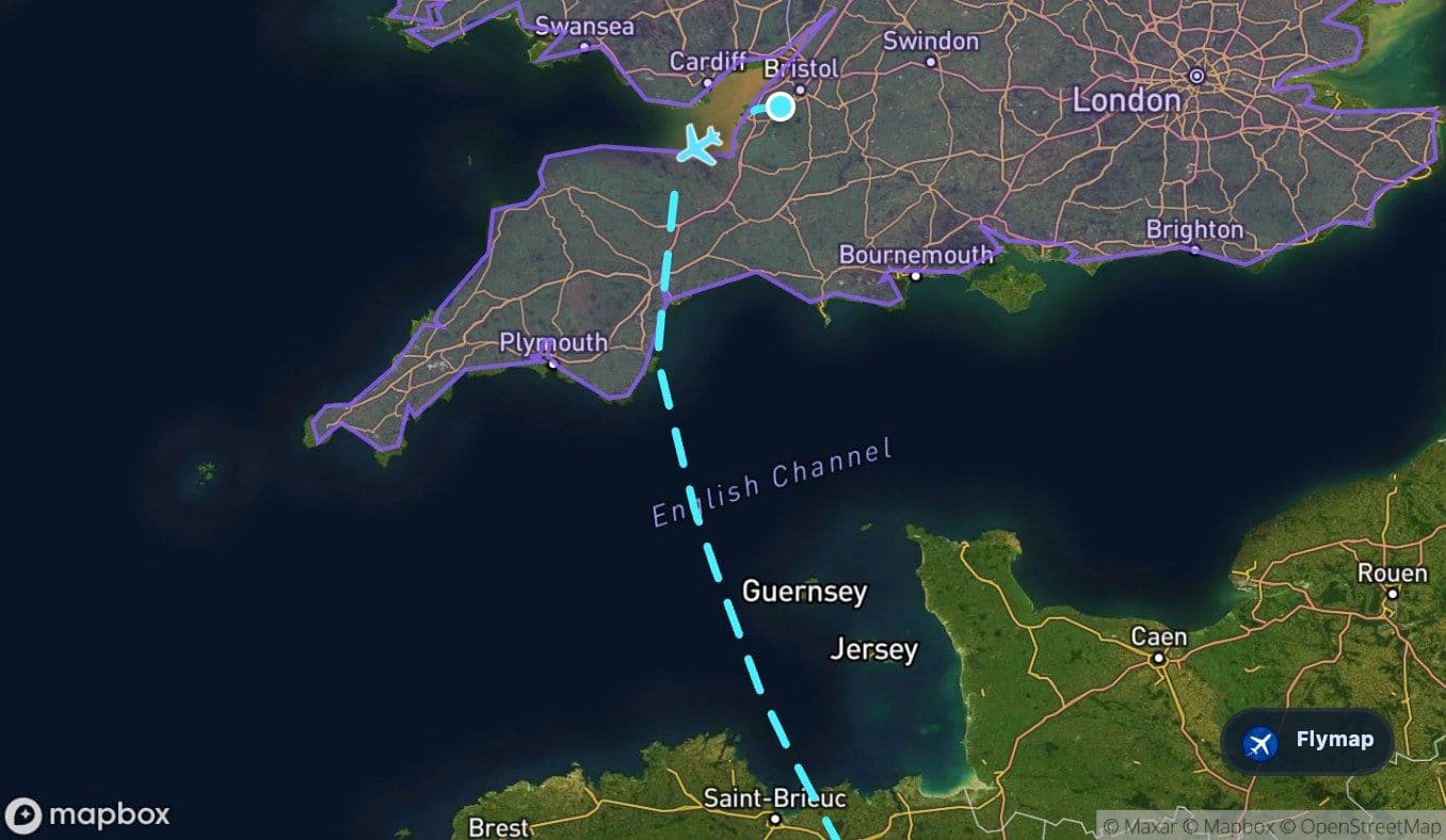
 Bristol ChannelEnglish Channel
 North European Plain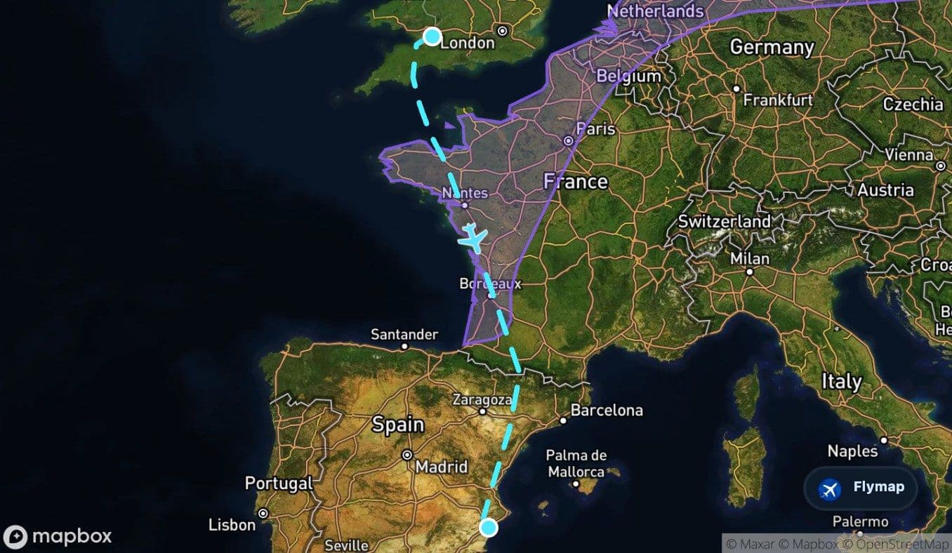
 France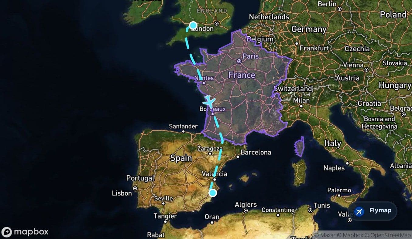
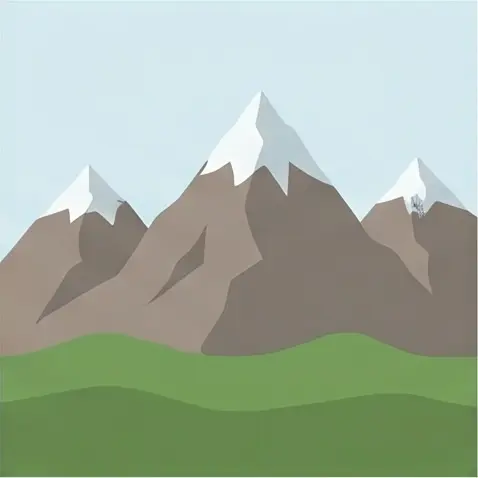 Pyrenees
 Iberian Peninsula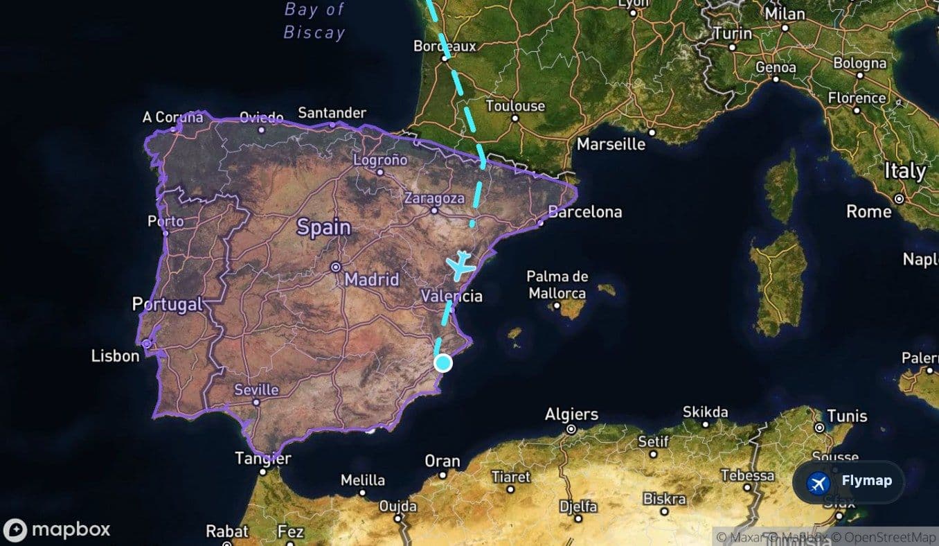
 SpainAlicante-Elche Miguel Hernández
This flight begins in the green, tidal southwest of Britain and ends in the warmer, drier landscapes of Spain’s Mediterranean side. Between Bristol and Alicante, the view shifts from estuaries and channels to French plains, then suddenly to the Pyrenean barrier before the aircraft continues across the Iberian Peninsula. Flymap helps make those changes easier to follow from the window, especially when coastlines, rivers and mountains appear only briefly between clouds.
Leaving through a tidal edge
The route starts over the United Kingdom and Great Britain, but the land section is brief. Soon after departure, the aircraft reaches the Bristol Channel, a wide tidal channel between southwest Britain and Wales. From above, this early stage can feel like a quick handover from inland Britain to a more maritime landscape: coast, estuary, shallow water and indented shoreline.
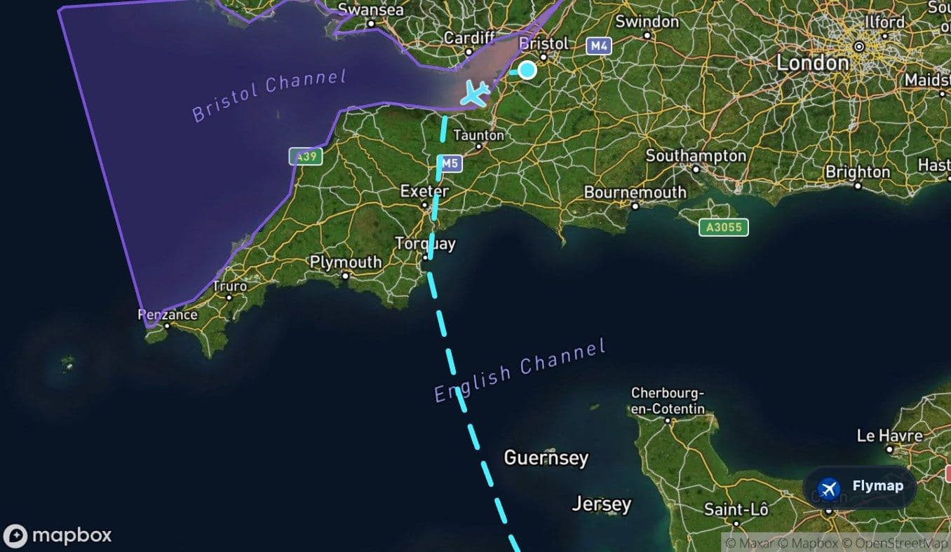
The route data places several notable features in the wider early-flight area, including Glastonbury Tor, Flat Holm, Steep Holm, Lyme Bay and coastal landmarks such as Lulworth Cove and Old Harry Rocks. Visibility will depend on seat side, weather and the precise track, but the character of this section is clear: Britain is left behind through a coast shaped by tides and channels rather than a simple straight shoreline.
The Channel as a threshold
After the first coastal transition, the flight crosses the English Channel. This is the route’s first major sea crossing and the clearest boundary between the departure-side landscape and continental Europe. The water below is not an empty gap; it is a busy maritime passage with strong tides and a complex fringe of islands, rocks and coastal shallows.
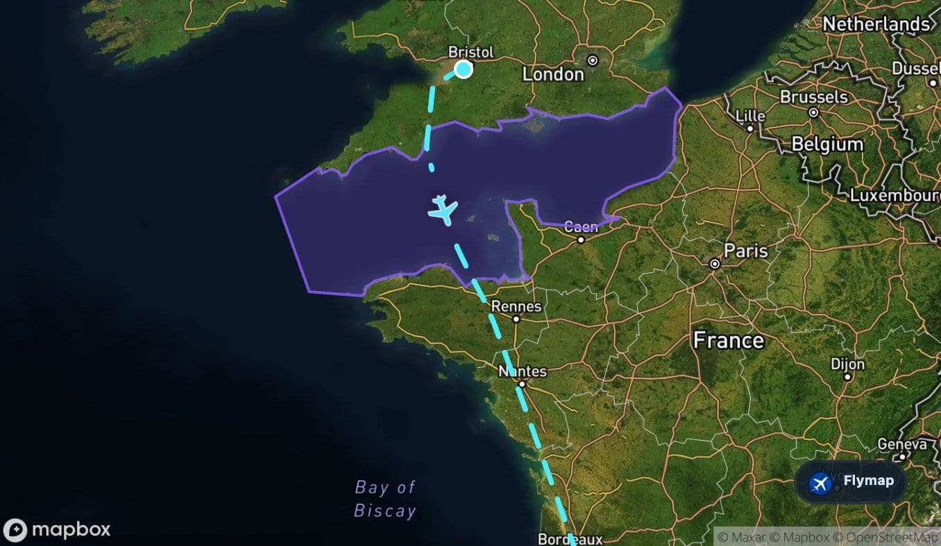
The surrounding point-of-interest set includes Guernsey, Sark, Herm, Alderney, the Channel Islands and the Chausey Islands. Some may be too distant or cloud-covered on a given day, but they explain why this stretch can look intricate from the air: pieces of land interrupt the sea, while the French and British coasts frame the crossing from opposite sides.
France: the long flattening of the route
Once over France, the flight enters its longest middle chapter. The dossier describes France here as a mix of coastal plains, river basins and, farther south, the approach to mountain ranges. Compared with the jagged coastlines and islands of the Channel, this part of the route may look broader and more regular: fields, towns, roads and rivers arranged across a wide landscape.
The route also passes through the North European Plain, a vast lowland region across northern Europe. On this flight, it represents the flattening transition between the sea crossing and the later rise of the Pyrenees. Places listed in the route’s wider geography include Nantes, Bordeaux, Pau and several river systems of western and southwestern France, including the Charente, the Sèvre Niortaise and smaller tributaries.
This is where Flymap is useful in a quieter way. The view may not announce itself with a single dramatic landmark, but the moving map gives context to the long continental section and shows how the aircraft is gradually trading northern lowlands for the south of France.
The Pyrenees break the pattern
The Pyrenees are the strongest visual contrast on the route. After the lower, wider landscapes of France, the terrain tightens into a long mountain range that forms a natural barrier between the Iberian Peninsula and the rest of Europe. Even if clouds hide some detail, the change in structure can be obvious: ridges, valleys and high ground replacing the flatter geometry of the plains.
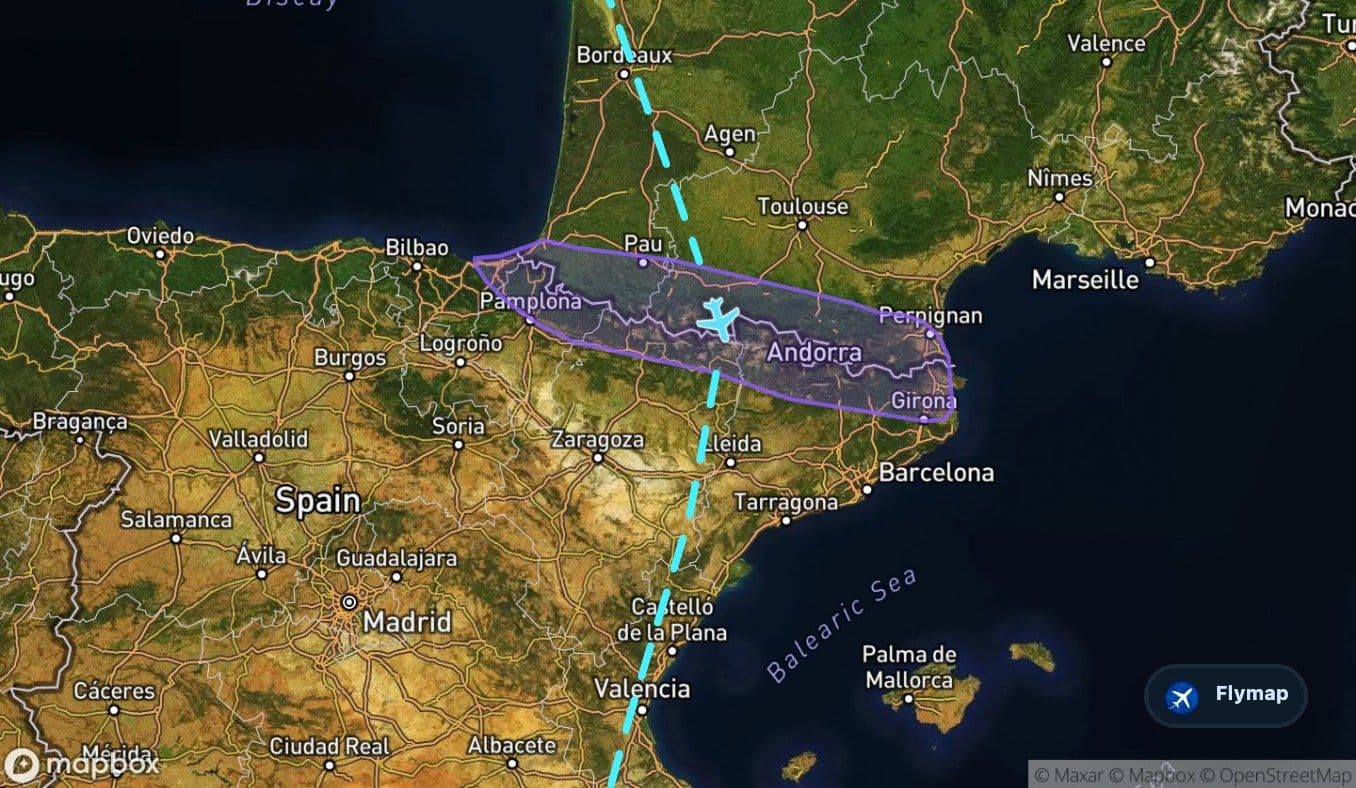
The route’s point-of-interest data includes several Pyrenean features, such as Pic du Midi d’Ossau, Vignemale, Aneto, Pic du Midi de Bigorre and Monte Perdido. The exact view from a passenger seat will vary, but this is the part of the journey most likely to feel like a real geographic threshold rather than just another segment of cruise.
Spain and the pull toward Alicante
After the mountain crossing, the route enters Spain and the Iberian Peninsula. The dossier describes this region as a broad plateau with mountain ranges along the edges and plains between them. From the window, the final part of the flight may feel more open and drier than the earlier stages, with the route gradually turning into a Mediterranean approach rather than a northern European crossing.
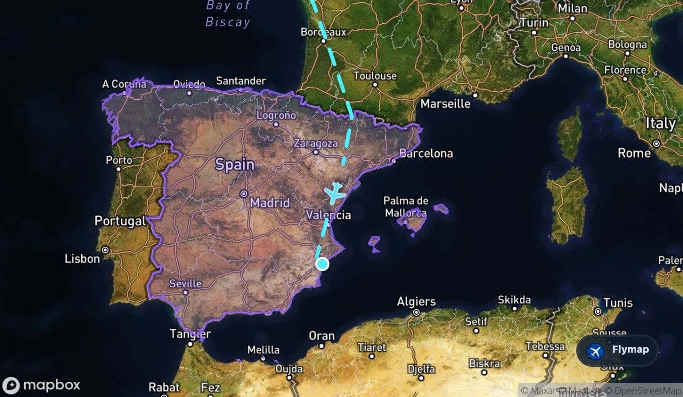
The Spanish section includes nearby references such as Huesca, Monzón, the Cinca, the Segre, the Ebro river system, the Júcar, the Gulf of Valencia, Valencia, Serra d’Aitana, Benidorm Island and Illa de Tabarca. Closer to Alicante, the landscape becomes increasingly tied to Spain’s eastern coast: mountains, plains and Mediterranean water all sit within the wider arrival-side geography.
That is the route’s main contrast in miniature: a departure through tidal Britain, a crossing into continental plains, a sharp mountain wall, and a final approach toward Mediterranean Spain.
Based on a historical route track for FR2292.
Route Gallery (10 images)
Download this or any other flight map in Flymap app
Open Flymap on your phone for app-store download links and offline-ready flight maps.


Flymap app