June 16, 2026
London to Gran Canaria: The Long Atlantic Run
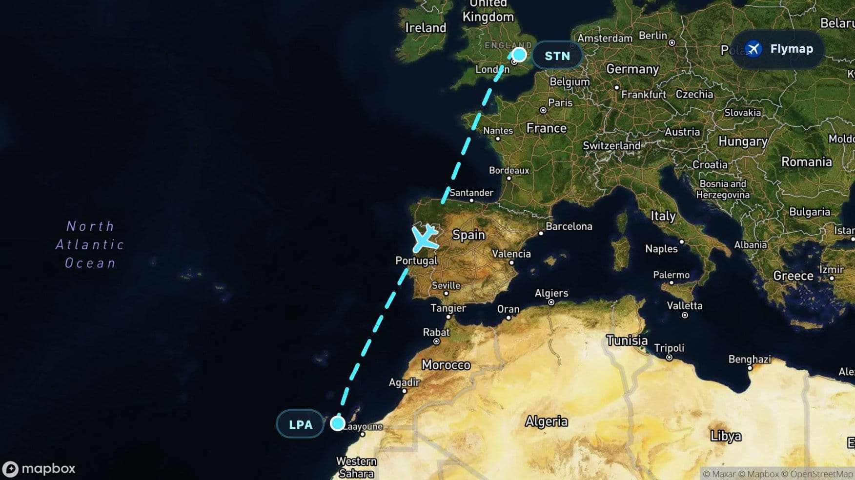
See what you may fly over from London Stansted to Gran Canaria, including United Kingdom, British Isles, Great Britain, English Channel and France.
Distance
3,087 km
Timing
3h 50m
Countries
4 countries
 London Stansted
 United Kingdom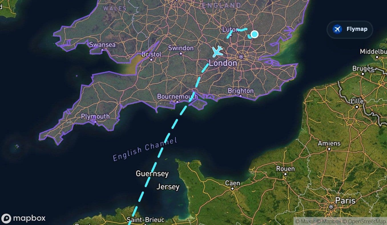
 British Isles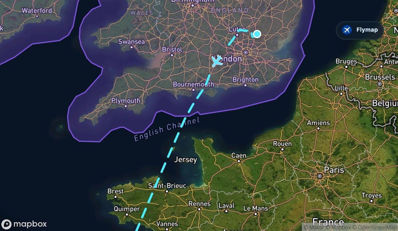
 Great Britain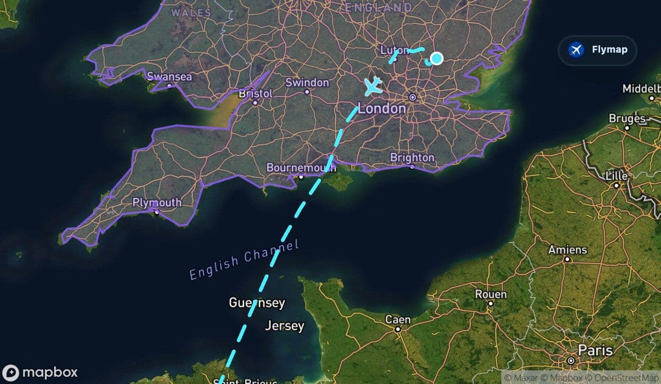
 English Channel
 France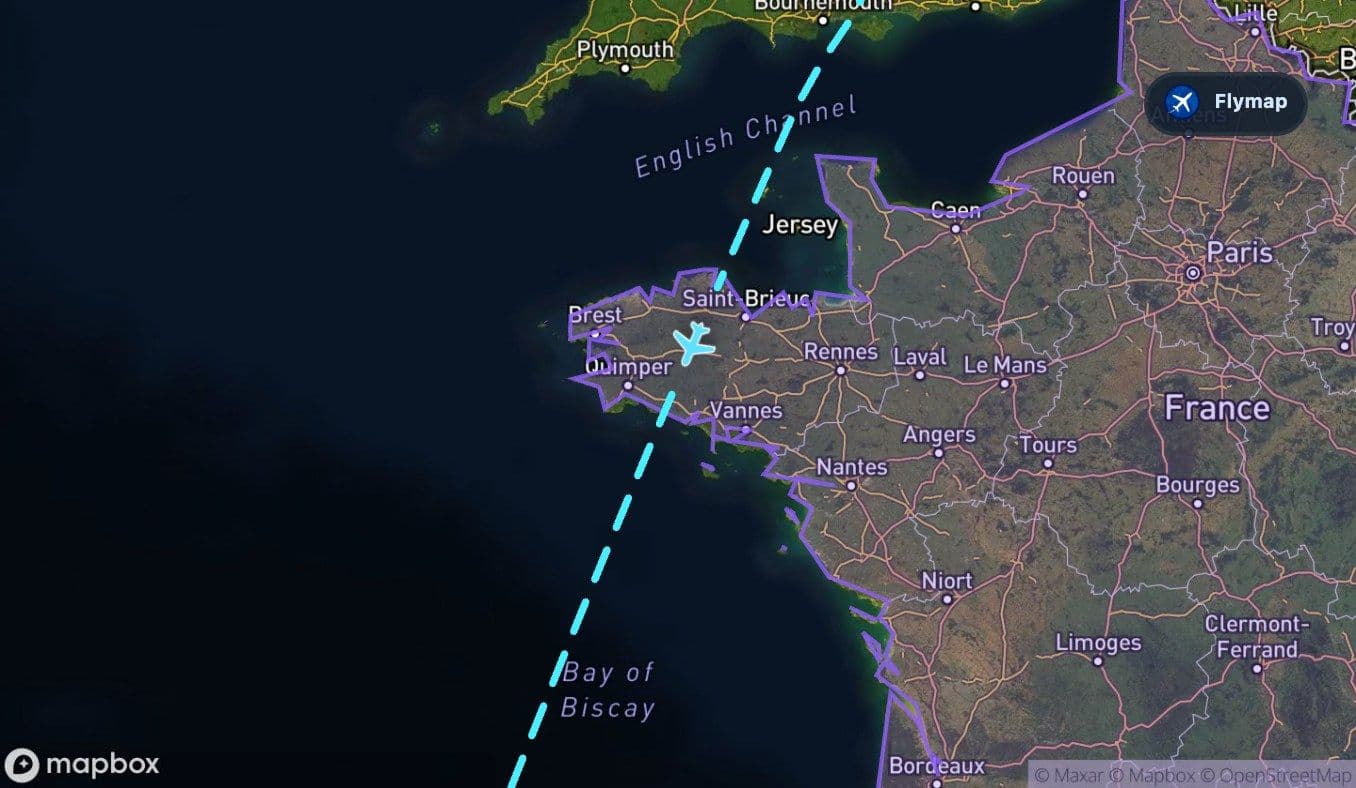
 North European Plain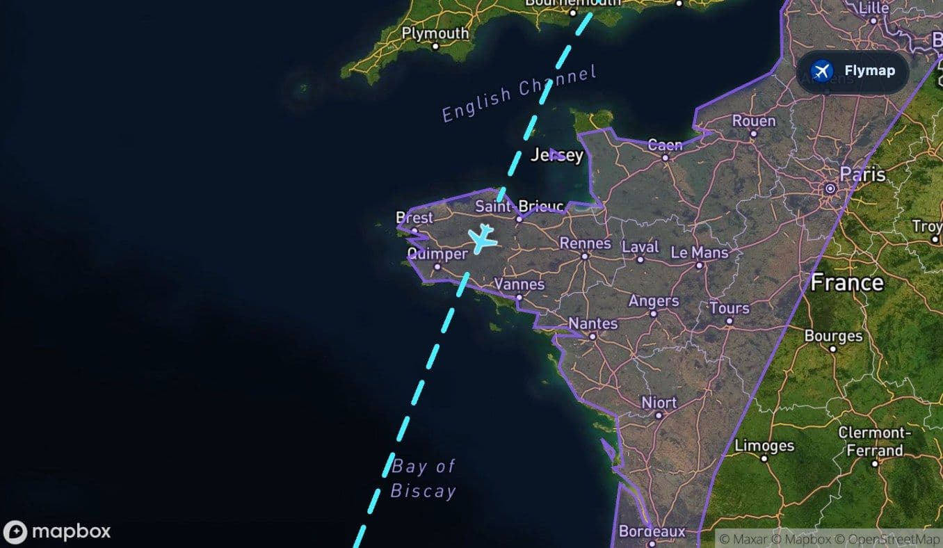
 Bay of Biscay
 Iberian Peninsula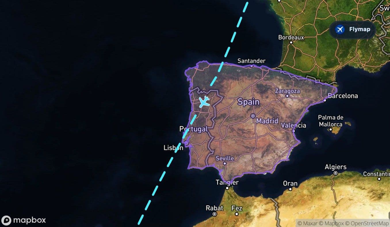
 Spain
Spain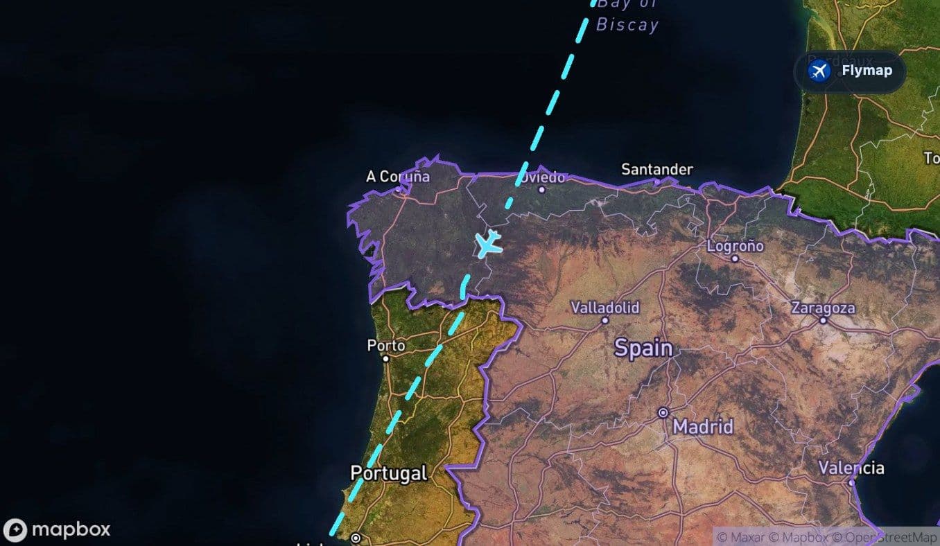
 Cantabrian Mountains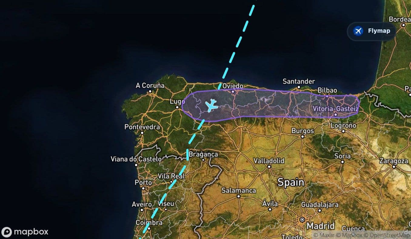
 Portugal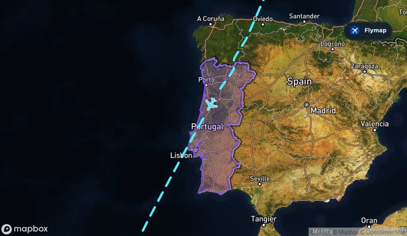
 Atlantic OceanCanary IslandsGran CanariaGran Canaria
The defining view on a London to Gran Canaria flight is the Atlantic. The route does not just hop from Britain to Spain; it gradually trades the patchwork of northern Europe for wide ocean, then waits for the Canary Islands to rise from the blue. That long water section is the visual anchor of the journey, and it makes the final sight of Gran Canaria feel much more dramatic.
Flymap helps you follow that change from the window: first the Channel, then the Bay of Biscay, then Iberia, and finally the open Atlantic approach to a volcanic island.
The Channel is the first break in the land
The flight leaves Stansted over Great Britain, with the early view shaped by southeast England’s towns, fields and river patterns. Soon after departure, the land gives way to the English Channel.
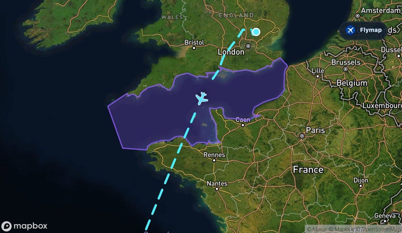
This is the first proper water crossing on the route. It is narrow compared with what comes later, but from the window it can still feel like a clear threshold: Britain behind, France ahead, and the route already bending toward the ocean side of Europe.
On a clear day, the Channel may show coastlines, shipping lanes, cloud shadows and the pale edge where land meets shallow sea. If the sky is hazy or cloudy, Flymap is useful because the aircraft may cross this section before you can visually place it.
France passes quickly beneath the route
After the Channel, the route touches France and the North European Plain. This is a relatively short land section, so it may not feel like a long overflight from the cabin.
The view is more lowland than mountainous here. Expect flatter terrain, agricultural patterns and broad river-basin landscapes rather than dramatic peaks. It is a short pause between two water-dominated parts of the journey: the Channel behind and the Bay of Biscay ahead.
The Bay of Biscay opens the route westward
The Bay of Biscay is where the flight starts to feel less like a simple Europe crossing and more like an Atlantic route.
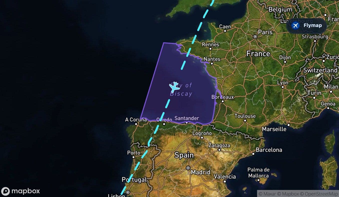
This bay lies between France and Spain, and the crossing is much broader than the English Channel. From above, it can appear as a wide blue curve before the aircraft reaches northern Spain. The coastline around this part of Europe is also more rugged than the lowland edges near the Channel, so the transition from sea to land can be visually sharper.
The Channel feels like a border crossing. The Bay of Biscay feels like the first real invitation into the Atlantic.
Northern Spain: mountains at the ocean edge
When the aircraft reaches the Iberian Peninsula, it crosses Spain and the Cantabrian Mountains. This section is brief but important because it gives the route a strong visual contrast: sea, coast, then mountains.
The Cantabrian Mountains run along northern Spain and form a barrier between the coast and the interior. From the window, mountain ridges and green valleys may appear soon after the ocean crossing, especially if visibility is good.
After that, the route continues across the Iberian Peninsula and into Portugal. The landscape becomes a mix of plateau, river corridors and Atlantic-facing terrain. This is the final major landmass before the long ocean stretch begins.
Portugal is the last mainland before open ocean
Portugal marks the route’s last extended land view before the aircraft heads out over the Atlantic. Rivers flow westward toward the ocean, and the land gradually gives way to coastal edges and open water.
For passengers, this is a good moment to check the map. After this point, the flight becomes visually simpler but emotionally more distinctive: less land detail, more ocean, and the slow approach to an island chain far from mainland Europe.
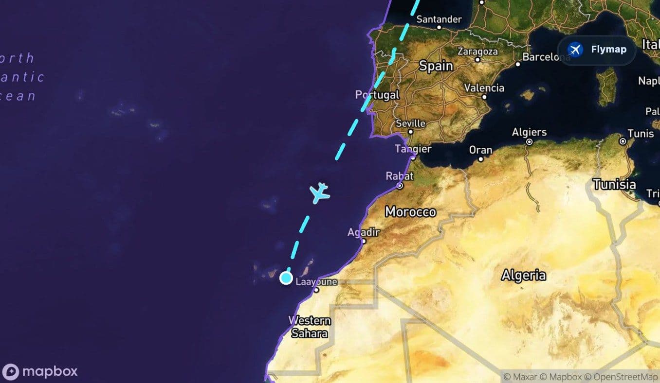
The Atlantic section is the longest single geographic feature on this route. For a large part of the final journey, the view may be mostly water, cloud tops and horizon. That can sound empty, but it is part of what makes the route memorable. You are no longer moving between nearby coastlines; you are crossing open ocean toward volcanic islands.
Waiting for the Canary Islands
The Canary Islands appear near the end of the flight, and their arrival changes the view quickly. Instead of continuous ocean, the map begins to show an Atlantic archipelago: islands separated by water, built from volcanic terrain and shaped by steep relief.
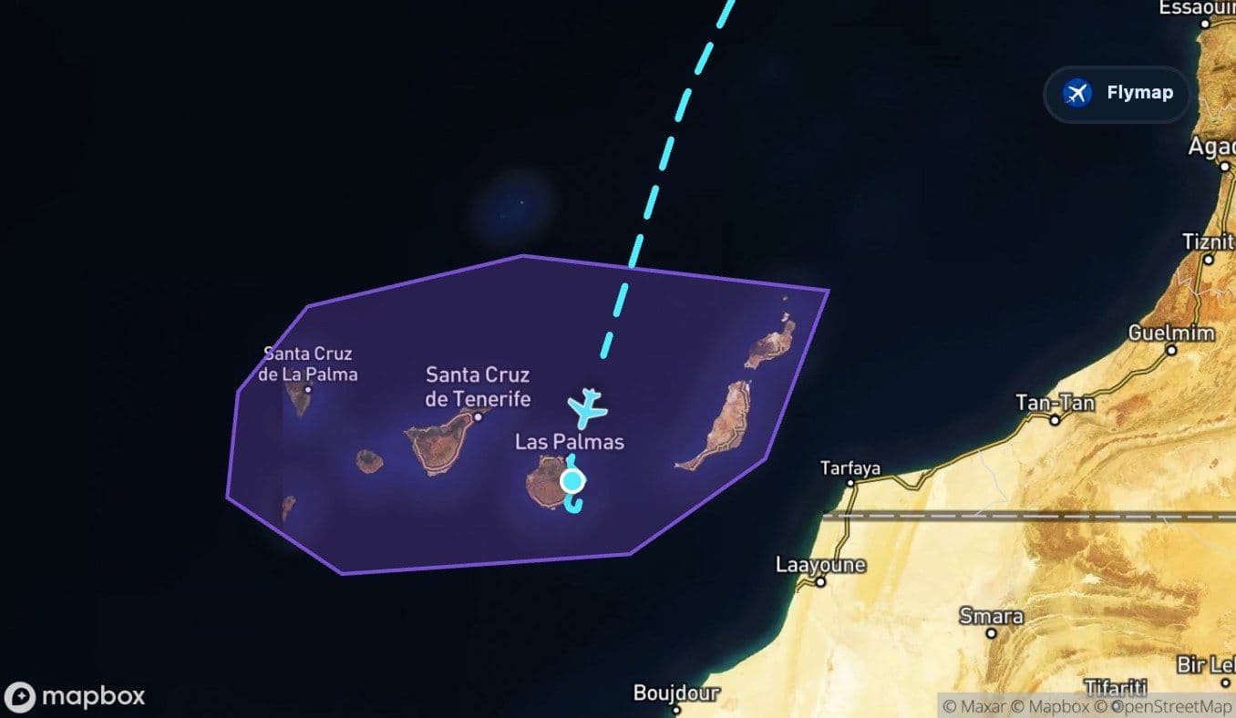
From above, this is the moment the route becomes island-focused again. The Canary Islands are not a flat beach destination when seen from the air. They are rugged, volcanic and varied, with coastlines, mountains and dry-looking landscapes sitting close together.
Gran Canaria: the island target
The final approach is into Gran Canaria, a volcanic island with steep central mountains and deep ravines. The overflight of the island itself is short, but it is one of the most rewarding parts of the journey because the terrain changes so quickly after the long ocean section.
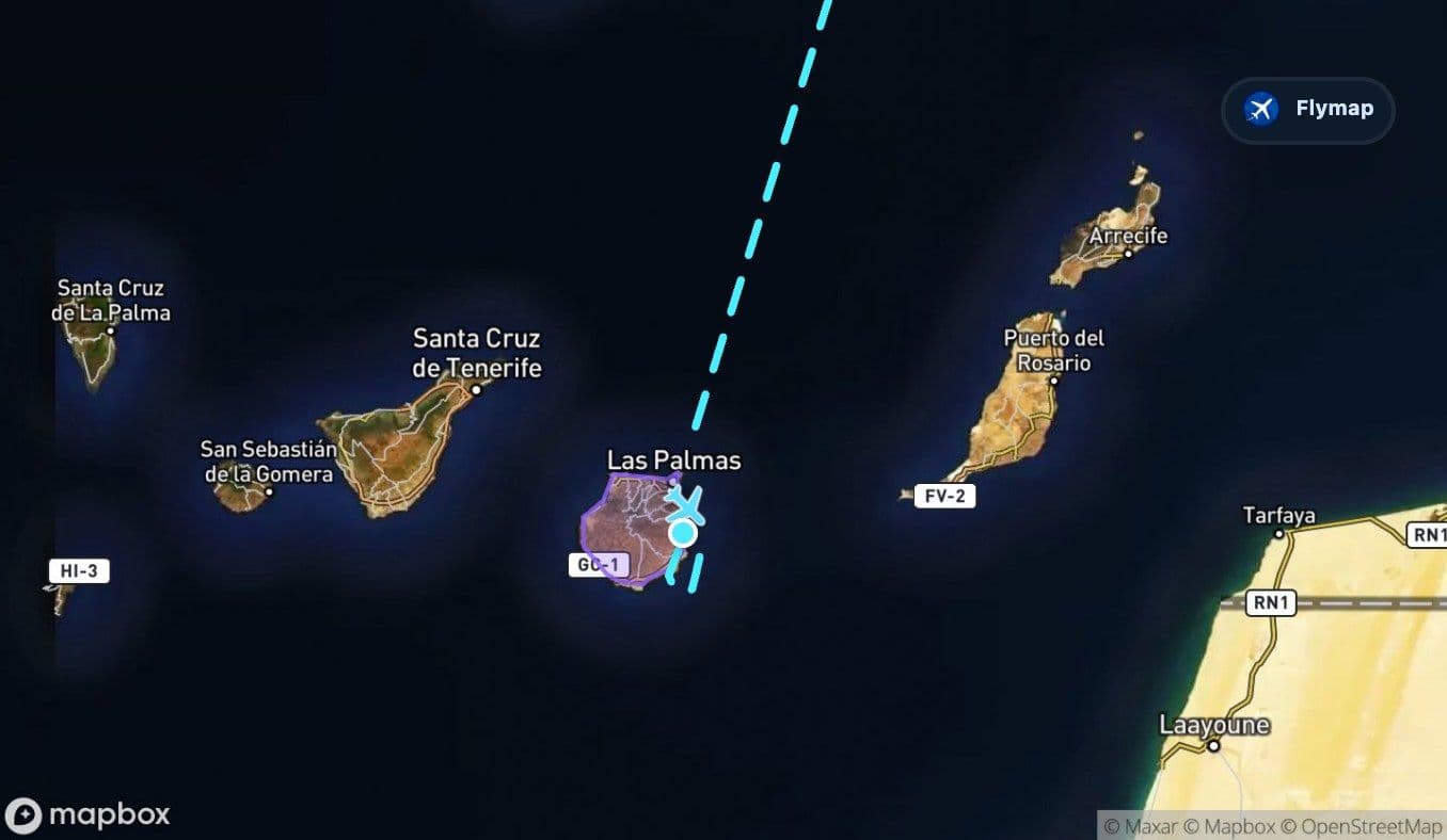
Depending on approach direction and visibility, passengers may notice dry coastal areas, darker volcanic textures, ridges, ravines and the island’s compact shape surrounded by Atlantic water. The airport sits on the island’s eastern side, so the last minutes can feel like a fast transition from ocean to land to runway.
Route summary
- The route leaves Great Britain and quickly crosses the English Channel.
- The Bay of Biscay is the first broad Atlantic-facing water feature on the flight.
- Northern Spain adds a short mountain section over the Cantabrian Mountains.
- Portugal is the last mainland stage before the long Atlantic crossing.
- The final approach brings the Canary Islands and Gran Canaria’s volcanic terrain into view.
*Data based on a historical route track for FR2812.
Route Gallery (14 images)
Download this or any other flight map in Flymap app
Open Flymap on your phone for app-store download links and offline-ready flight maps.


Flymap app