Flymap guide
What am I flying over? How to identify what’s below your plane
Every window-seat traveller knows the moment: a dramatic mountain range, a huge lake, a city glowing at night — and no idea what any of it is called. Asking “what am I flying over?” usually gets a shrug, and without Wi-Fi you can’t look it up. Here are the ways to actually get an answer, ranked from clunky to great.
Option 1: the seatback moving map
If your plane has one, the seatback map shows roughly where you are. But it zooms how it wants, labels only major cities, knows nothing about that fjord or volcano, and on budget airlines it simply doesn’t exist (see what to do when there’s no seatback screen).
Option 2: study the route before you board
Aviation geeks do this: look up the typical flight path, memorise the big landmarks in order, then match them out the window. It works — roughly — until clouds, reroutes or a nap break the chain. It’s much easier with a tool that previews the route for you: the Flymap web map shows the corridor and its landmarks for any pair of airports, free, in your browser.
Option 3: GPS + offline maps (works on any plane)
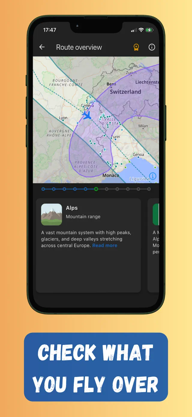
Your phone’s GPS works in Airplane mode, so with maps downloaded in advance it can pinpoint you over the planet with no connection at all. This is exactly what Flymap is built for:
- A “You are flying over” panel that names the country, region and natural features under you right now — and what’s coming next.
- Point-of-interest cards for mountains, lakes, cities, parks and coastlines along the corridor, with short descriptions.
- Offline Wikipedia bundles for your route, so you can read the full story of the Alps while flying over them.
- A route timeline that lists everything you’ll cross, with rough timings — great for knowing when to look up from your movie.
Get the window seat that sees it
Knowing what you’re flying over is only half the game — the other half is sitting on the side of the plane that faces it. Our window seat guide covers picking a side for your route, avoiding the wing, and timing flights for golden-hour views.
Frequently asked questions
Can I find out what I flew over after landing?
Yes. If you tracked the flight in Flymap, the route and its regions stay saved on your device, so you can scroll back through the corridor and its landmarks any time.
Does it work over the ocean?
GPS works everywhere, including over oceans. Flymap still shows your position, speed and progress, and names seas, straits, islands and coastlines along the way.
Do I need to know my flight number?
No — just the departure and arrival airports. Flymap builds the likely corridor between them, which is what you'll see from the window.
Try it on your next flight
Get Flymap free on iPhone or Android, download your route before boarding, and see what you fly over — no Wi-Fi needed.


Flymap app
Keep reading
The window seat guide: how to get the best views on any flight
Choosing the right side of the plane, dodging the wing, timing the light, and putting names to what you see below.
Does GPS work in airplane mode?
Short answer: yes. Why your phone’s GPS keeps working with every radio off, why it’s allowed on planes, and how to actually see yourself on a map.
Offline flight maps: see your whole route without internet
What an offline flight map is, why you should download one before boarding, and how to follow your whole route — no Wi-Fi, no roaming.